Autonomous Mobile Robot DesignLevel: CS491/CS691
Overview: The goal of this course will be to introduce students into the holistic design of autonomous robots - from the mechatronic design to sensors and intelligence. The course will have five "teaching blocks", namely: a) actuation and robot locomotion, b) sensing and robot perception, c) control and robot guidance, d) motion planning and autonomous navigation, e) remote control and robot GUI and will be 100% project-driven. The students will be organized in teams and each team will design a robot in order to solve a specific application and challenge. As an example: a team project might be "aerial robots for multi-modal characterization of industrial facilities" or "robots with advanced traversability abilities for mountain operations". The final challenges will be derived based on real-requirements of federal agencies or needs of specific industries. Overall the course aims to develop fundamental knowledge in robotics and engage both undergraduate and graduate students in cutting-edge research. Key-features of the course and what makes it different:
The material of the course will be available at the beginning of Fall 2016. Please send me an e-mail ([email protected]) if you are interested to be participate in this course. |
Course Material
Course Projects Synopsis
Project #1: GPS-denied Autonomous Car Localization in Visually-degraded Conditions
Description: GPS-denied localization employing vision and LiDAR sensors is an extensively studied field currently working reliably in simple, featurefull or geometrically structured environments. However, when in visually-degraded conditions and ill-conditioned geometry the problems remains particularly challenging. The goal of this project is to enable GPS-denied Simultaneous Localization And Mapping (SLAM) for autonomous cars navigating subject to rain, snow or ice.
Research Tasks:
Project #2: Change Detection for Autonomous Driving
Description: When a vehicle navigates continuously within a certain area, exploiting its previous map to localize robustly within it and pre-plan its actions leads to optimized performance. For this process to be reliable, spatio-temporal change detection has to take place. However, change detection is challenging both in terms of correlating the input data and maps, as well as in terms of map scalability.
Research Tasks:
Project #3: Robotic Inspection of Mines
Description: Mine inspection corresponds to a major challenge due to the difficult environments and the often visually-degraded conditions. This project refers to the development of an aerial and ground robotic system that aims to enable systematic 3D mapping and semantic classification.
Research Tasks:
Description: GPS-denied localization employing vision and LiDAR sensors is an extensively studied field currently working reliably in simple, featurefull or geometrically structured environments. However, when in visually-degraded conditions and ill-conditioned geometry the problems remains particularly challenging. The goal of this project is to enable GPS-denied Simultaneous Localization And Mapping (SLAM) for autonomous cars navigating subject to rain, snow or ice.
Research Tasks:
- Task 1: Vision, NIR, LiDAR System Integration
- Task 2: Vision, NIR, LiDAR Sensor Fusion
- Task 3: Dataset collection and groundtruth stamping using GPS
- Task 4: Field experiments and evaluation
Project #2: Change Detection for Autonomous Driving
Description: When a vehicle navigates continuously within a certain area, exploiting its previous map to localize robustly within it and pre-plan its actions leads to optimized performance. For this process to be reliable, spatio-temporal change detection has to take place. However, change detection is challenging both in terms of correlating the input data and maps, as well as in terms of map scalability.
Research Tasks:
- Task 1: Change detection in images
- Task 2: Volumetric mapping
- Task 3: Change detection in volumetric maps
- Task 4: Semantic change classification using convolutional neural nets
- Task 4: Dataset collection and groundtruthing
- Task 5: Field experiments and evaluation
Project #3: Robotic Inspection of Mines
Description: Mine inspection corresponds to a major challenge due to the difficult environments and the often visually-degraded conditions. This project refers to the development of an aerial and ground robotic system that aims to enable systematic 3D mapping and semantic classification.
Research Tasks:
- Task 1: Platform development (ideally based on existing robots at the lab)
- Task 2: Volumetric and surface mapping
- Task 3: Aerial - to -ground robot collaboration
- Task 4: Dataset collection and groundtruthing
- Task 5: Field experiments and evaluation
Study links |
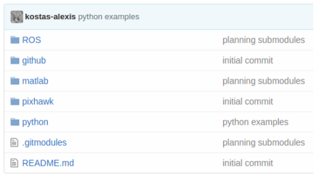
Open-Source Code• Code Repository: https://github.com/unr-arl/autonomous_mobile_robot_design_course
• NBVPlanner: https://github.com/ethz-asl/nbvplanner |
More |
